 " />
" /> 
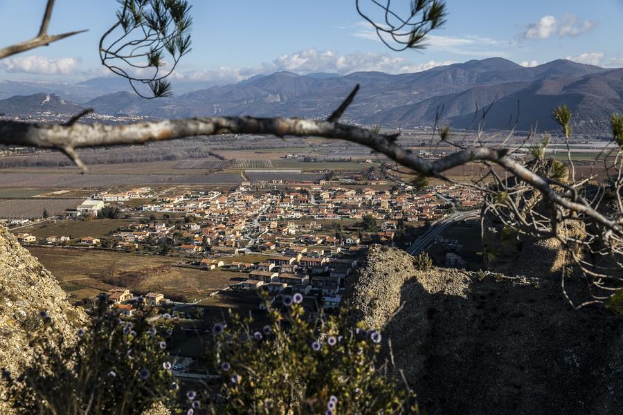
The path of the Colle takes you to the “Haute Montagne” from where the view extends over the aromatic crops of the Puimichel plateau. This circuit is also an opportunity to discover old ruined farms.
Departing from Place de la République in Le Mées, join the Route d’Oraison, which you leave after a few meters to join the EDF canal on your left. After having crossed it, the path enters a small ravine then “attacks” the hill quite sharply in the middle of the white oaks and the holm oaks, typical of the Mediterranean forest. Gradually, the slope softens and you reach the ruins of the Chamoyes farm, where, at the beginning of the 20th century, the school of the surrounding “campaigns” was held. A few hundred meters further, you reach the plateau of Puimichel whose extraordinary luminosity and the fragrance of aromatic plants are unforgettable. From there, the circuit branches off to the right (while the left path takes you to Les Pénitents or PR de Malijai.)
After 1km leave the plateau to reach, on your left, the Apollinaire ruin before descending into the Aubrespins valley, the Provençal name given to the hawthorn tree. The end of the route is 2km, via a small tarmac road in the middle of olive trees, emblems of the region. Then you finally reach the canal and the village of Les Mées.
- Circuits de France
- Open air
- Listed PDIPR
Rates
Free access.- Level red – hard
- French
GPX tracks


Updated on 14/02/2025 – Office de Tourisme Provence Alpes Digne les Bains – Suggest an edit