 " />
" /> 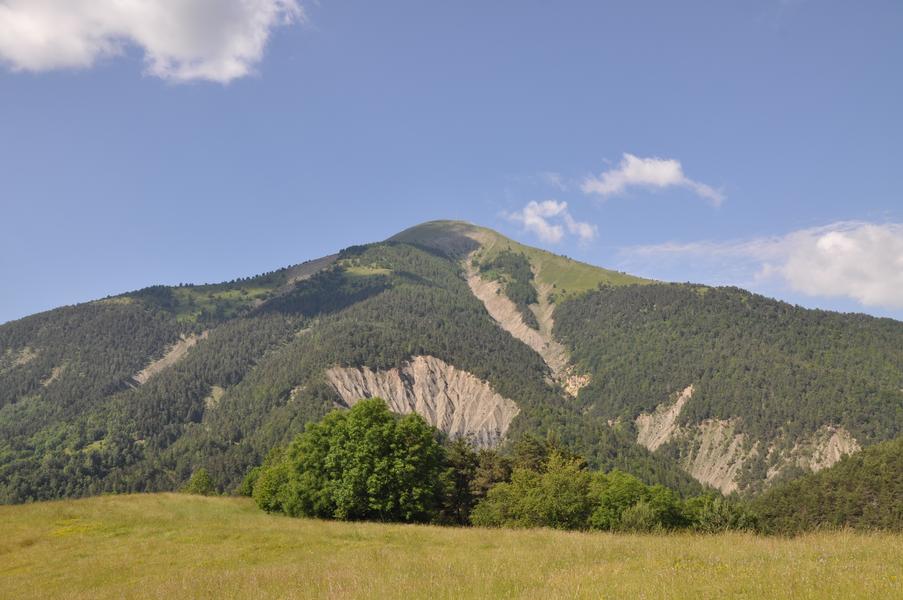
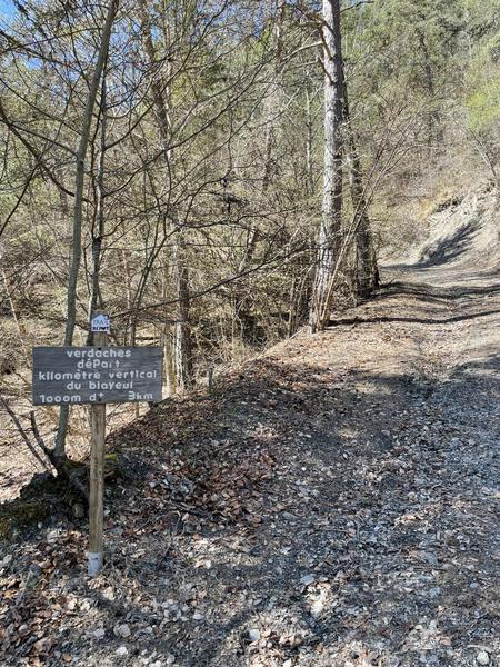
1,050m of ascent over less than 4.6km! Impressive? In any case, that’s what awaits you on this Kilomètre Vertical. The scenery is magnificent and the panoramic view from the top of Le Blayeul is exceptional
After a short kilometer of warm-up on flat ground along the river, you will undertake the ascent of Blayeul and its KV, made up of 70% undergrowth trail and 30% mountain pasture and designed for performance! Milestones are set up every 100m of elevation (maximum slope 75%!).
Hiking car park (1 m) – Return to Verdaches, cross the village and continue to the departmental road. Turn left then right at the fountain to take the footbridge and cross the Bès. Come out at a crossroads.
Post Passerelle du Bès (1 m) – Follow the track to the right. It passes in front of a building then begins to climb into the foothills of Blayeul. From there, the vertical kilometre begins. Shortly after the first hairpin bend, climb up the path rising to the left. A little higher up, cross a track and continue to climb on the path opposite. At the crossroads of “la Serre”, continue to climb. The pine forest then turns into larch forest. Continue along the ridge to emerge into the pastures near a barely visible crossroads.
Blayeul Pastures Post (1 m) – Continue to climb to the right in the mountain pastures, there is no longer a visible path, follow the markers towards the summit. Further up, join the access track to the pylon. Cross it to reach Blayeul.
Blayeul Summit Post (2 m) – Return to point 189 by the same route. Go right and continue down into the mountain pastures, paying attention to the markings. Reach the access track to the Blayeul pastoral hut.
Post Follow it on the left then go down to the right on the path in front of the cabin. It goes down in bends in the forest and joins a trail. Turn left and continue until a crossroads.
Poteau Garéous (1 m) – Turn right and come out onto a wide track. Turn left then left again 420 m further on to follow a sled. It then turns into a path that goes around Garéous to the north, follows a ridge up to Coste Morine then down. Further down, it leaves the ridge on the right to join a sled. Continue to go down to the left until a track. Turn left, go straight at the next crossroads and return to point 100. The return to the starting car park is via the same route as that taken on the way out (marked).
Provence Alpes Agglomération
Le Village, Route du Mardaric,
04140 Verdaches
Telephone : +33492351100
- Circuits de France_POI
- Open air
Rates
Free access.- Level black – very hard
- French
- Free car park
- Car park
GPX tracks


Updated on 14/02/2025 – Office de Tourisme Provence Alpes Digne les Bains – Suggest an edit